Software
This page summarises the software that MASS members have been developing.
MASS GitHub Organisation
We have an GitHub organisation which is a central repository for lots of MASS-related code.
https://github.com/orgs/MassAtLeeds/
Flexible Modelling Framework
details to come..
Geographical Analysis Machine (GAM)
The GAM was originally developed by Stan Openshaw and colleagues and can be used to search for clusters in area data. It is particularly useful when the population at risk is important. There is a Java version available on the CCG website with an accompanying tutorial. It also features in the new Geospatial Analysis book.
RepastCity
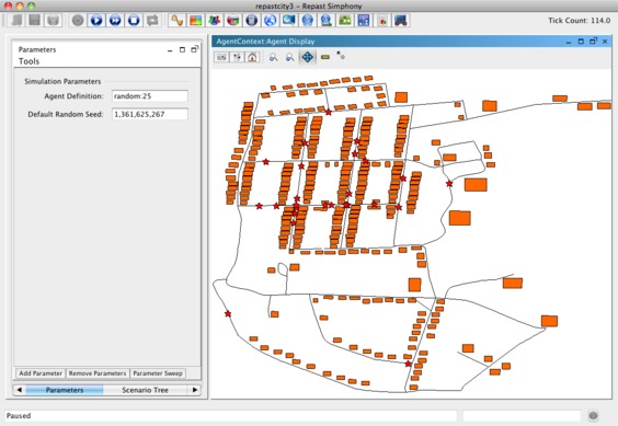
RepastCity is a small Repast Simphony program that demonstrates how to create a virtual city and move some agents (people) around a road network. Available for download at https://github.com/nickmalleson/repastcity.
SpatialTest
The SpatialTest program can be used to run a spatial point pattern test which was developed as part of Martin Andresen’s PhD Dissertation. The test is area based (it counts the number of points per area) and measures the degree of similarity at the local level between two spatial point patterns. The software has been written by Nick Malleson in Java and has a graphical user interface that can be used to run the test. Available to download at https://github.com/nickmalleson/spatialtest.
k-means demonstrator
The k-means demonstrator is a small program which demonstrates how the k-means clustering algorithm works in two dimensions.